


 A project initiated by the World Bank and AidData look to encourage direct participation from citizens and local communities in World Bank’s programs, Mapping Results, is powered by GeoIQ’s geospatial visualization and analytics. This is part of the Open Data Initiative in which World Bank is actively getting involved with, thus, publishing the location of Bank-funded activities to as particular as provincial and district level, and in such robust detail.
“Mapping for Results is leading the way for transparency and accountability in the development community to deliver measurable results,” said Frank Moyer, CEO at GeoIQ. “For the first time ever citizens, project managers and donors will be able to independently explore and analyze the relationships between local need, project funding and results achieved.”
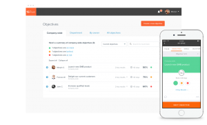
Through GeoIQ’s geospatial platform, users are able to collaborate through ease of data sharing, visualization and analysis, and are available for free and public use via GeoCommons. Some of its users include Federal Government Agencies, NGOs such as the United Nations, World Wildlife Fund and InterAction, as well several other enterprises, marketers and businesses. Mapping for Results program provides visibility to data such as poverty rates and Millenium Development Goal (MDG) data such as infant mortality rates, with geographical location of project and donors. HeoIQ currently covers visualization and analysis of 16,000 project activity sites for 2,277 active Bank-financed projects across 79 of the poorest countries.
“The objectives of Mapping for Results are to visualize the location of investment projects, better monitor project results and impact on people, enhance transparency and strengthen country dialogue and civic engagement,” said Aleem Walji, World Bank Institute Innovation Practice manager.
Geo data is a growing trend. Google recently extended its Google Maps and Google Earth Services with Google Earth Builder, a cloud-based enterprise tool for businesses to utilize their geo-spatial data and store it in the cloud. We’ve come to know only three companies to be working on definitive database of places that which are Google, Foursquare and Simple Geo. It seems like another one is getting into the competition, a company called Fwix. Geo data raises a lot of issues regarding privacy, and to some people, it should be regarded as something as unique as a person’s DNA because it becomes easy to deduce a person’s personality by his habits. This case is particularly addressed to smartphone geo data.
… We’d like to tell you about our mission and how you can help us fulfill it. SiliconANGLE Media Inc.’s business model is based on the intrinsic value of the content, not advertising. Unlike many online publications, we don’t have a paywall or run banner advertising, because we want to keep our journalism open, without influence or the need to chase traffic.The journalism, reporting and commentary on SiliconANGLE — along with live, unscripted video from our Silicon Valley studio and globe-trotting video teams at theCUBE — take a lot of hard work, time and money. Keeping the quality high requires the support of sponsors who are aligned with our vision of ad-free journalism content.
If you like the reporting, video interviews and other ad-free content here, please take a moment to check out a sample of the video content supported by our sponsors, tweet your support, and keep coming back to SiliconANGLE.